Showing posts with label mobile app. Show all posts

Friday, 12 December 2014

New 'Flood Risk' mobile app helps the public stay 'flood aware'

Free mobile app launched from Know Your Flood Risk aims to help homeowners, property purchasers and professionals quickly identify potential risk

With the Met Office predicting wetter-than-average conditions for December and January, and many parts of the UK recovering from the arrival of the recent ‘weather bomb’ gales, the team at the Know Your Flood Risk campaign has announced the launch of a free-to-download Flood Risk mobile app to help individuals quickly assess whether they are at potential risk of flooding.

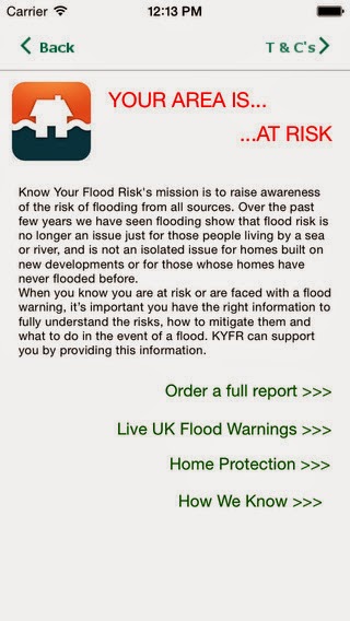
With the government pledging to publish more flood-related information to the wider public to improve the quality of public-focused services, the Flood Risk app, which is available to download from iTunes, provides an accurate view of current flood risk, using a range of data sources.

The app lets you input your postcode, where it will immediately assess the potential risk of flooding within a 25m zone of the given location.   The data is taken from Landmark Information Group’s ‘Know Your Flood Risk®’ report, which uses current data sources from National Flood Risk Assessment (NaFRA), the Environment Agency and surface water flooding data from JBA risk management.
 Flood Risk app
Mary Dhonau, Chief Executive of the Know Your Flood Risk campaign said: “Having been flooded on several occasions, I can personally vouch that being flooded is an absolutely appalling experience! Flood risk is not an issue just for those that live by the sea or near a river, but can affect homes as a result of surface water flooding, which many people don’t expect or plan for.  I therefore urge everyone to take a look at the app so they can instantly see whether they may be considered at risk.  Forewarned is forearmed, therefore if you fully understand your risk, you can plan prepare and take moves to protect against it.”

As well as providing a mapped view of a location’s flood risk, the Flood Risk app also provides access to live UK Flood Warnings from the Environment Agency, in addition to access to a free ‘Homeowner’s Guide to Flood Resilience’. This Guide offers practical advice on how homeowners can prevent and protect their home from flooding. It is also possible for users to purchase a detailed Flood Risk Report via the app, should they require a more detailed analysis of their home’s flood risk.
 Flood Risk app
According to the Environment Agency, approximately 5.2 million properties in England – which equates to on one in every six properties – is at risk of flooding. Of these, 2.4 million properties are at risk of flooding from rivers or the sea, while a further 2.8 million properties are considered vulnerable to surface water flooding.
 Flood Risk app
The Know Your Flood Risk Campaign provides consumers and professionals with a range of resources to help them prepare for, or mitigate the risk of flooding.  For more information, visit www.knowyourfloodrisk.co.uk
 Know Your Flood Risk

To download the app, click on: https://itunes.apple.com/app/id941612469

Tuesday, 9 December 2014

Landmark revolutionises Phase 1 environmental assessments with Envirocheck Analysis mobile app

·         New mobile app for Apple and Android devices enables full digitisation of Phase 1 environmental site assessments
·         Remote access to current maps, aerial photography and potential environmental risks now available whilst conducting a physical site walkover
·         Geo-locating technology can pinpoint specific site features and take accurate measurements
·         Synchronises information from site walkover back to the office, so no need to write- up notes

We are pleased to confirm the official launch of Envirocheck Analysis mobile app: a brand new mobile app for Apple and Android devices that enables environmental consultants and other land and property professionals to access digital mapping and environmental data whilst undertaking site walkovers for Phase 1 Environmental Site Assessments.

Consultants can digitally analyse current and historical maps, aerial photography and environmental data on their PCs using Envirocheck Analysis,  and now using the free-to-download mobile app they can view these complete workings (including mapping, photography, user-drawn features and environmental data analysis) whilst out onsite. 

Using built-in GPS and geo-locating technology, precise measurements are also recorded by the app, providing accurate reporting of key site features. The ability to synchronise this new information back to Envirocheck Analysis in the office, including digital notes, photos and videos captured on the mobile app, removes the need to manually collate and type up notes and is a real time-saver. 

One of the first clients to use the Envirocheck Analysis mobile app is Land Quality Management's Paul Nathanail, he comments: “In property transactions time is money. The Envirocheck Analysis mobile app represents a step-change in the way site walkover information is captured and transmitted back to the office. Interpretation and reporting can begin as soon as the visit is finished. Decisions can be made quicker; deals will happen and not be stalled.

Mark Burnard, Senior Product Manager at Landmark Information Group, adds: “With Envirocheck Analysis and the new mobile app, we’re taking the environmental site assessment process from being a paper-based task to a fully digital process.  The app provides users with mapping, data, information-capture tools and unsurpassable connectivity immediately at their fingertips.  It digitises the entire data collection and analysis process for Phase 1 environmental site assessments, removing the need to manually write-up notes, measure site details or rekey data on returning to the office.  Now, all site walkover notes are instantly ‘synced’ back to the Envirocheck Analysis desktop, streamlining the reporting process for all involved.”

Concludes Mark Burnard: “The launch of the Envirocheck Analysis mobile app is an important step forward in delivering a truly mobile environmental analysis solution.  By having access to data, map layers and notes in one place, consultants can now complete a site walkover with just a smartphone in their hand.  It’s a huge time-saver, delivers enhanced accuracy and ultimately will help provide time, cost and efficiency savings for both our current customers and new ones too.

For more information on Envirocheck Analysis and the Envirocheck Analysis mobile app, visit www.envirocheckanalysis.co.uk, telephone 0844 844 9952 or email customerservice@envirocheck.co.uk.